

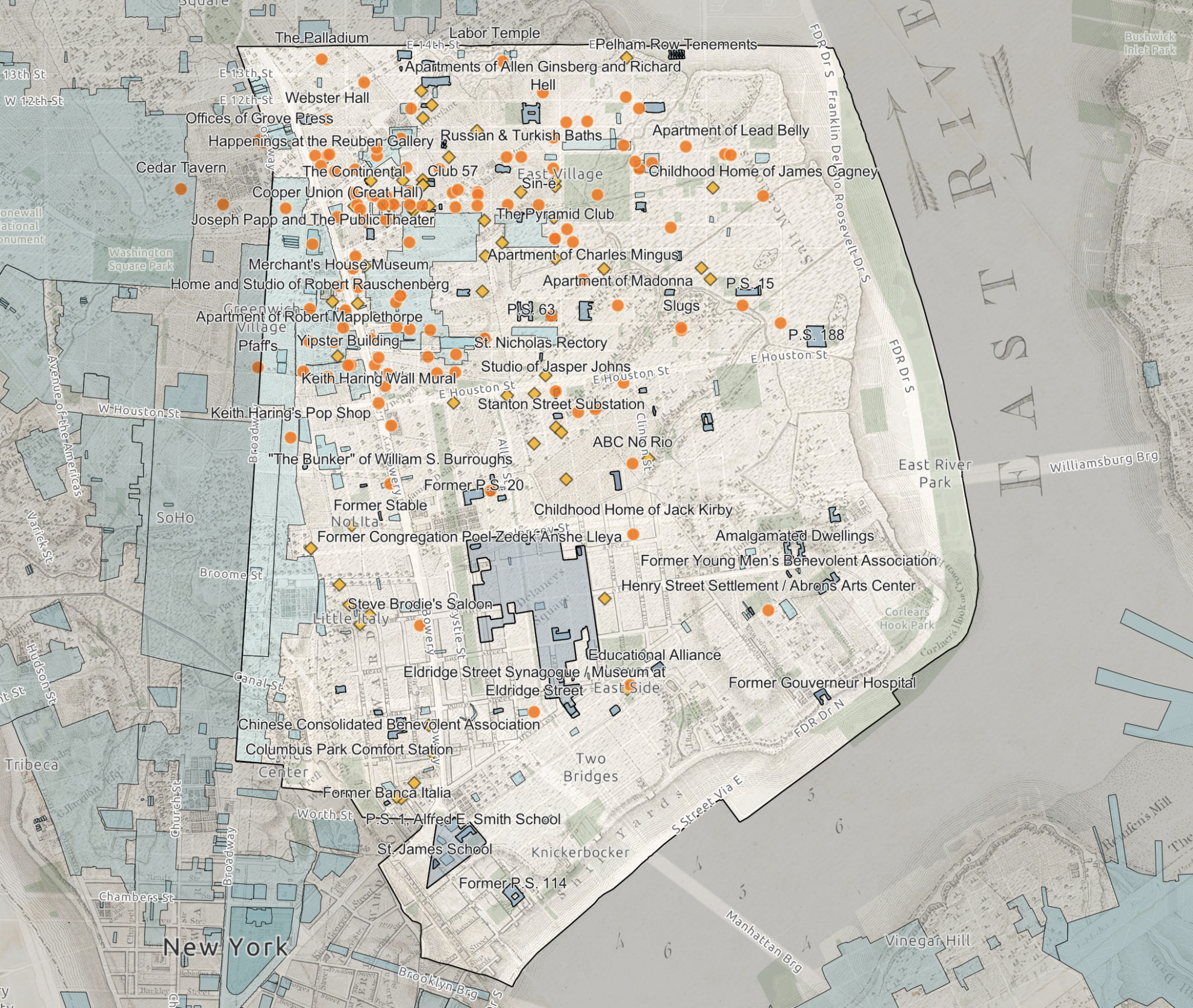
Lower East Side Layers is a navigable archive and advocacy tool commissioned by LESPI and created by Gray Matters, an East Village interdisciplinary art and design practice. Use the interactive interface to learn more about the history, culture, land use, and preservation efforts in the Lower East Side. This resource is an evolving document. Please reach out to merica.may@graymatters.nyc with corrections or suggestions.
The map is best viewed within GIS’s browser or smart phone app.
Visit THIS LINK to see this map in full screen.
General Navigation
- Zoom in or out for greater legibility
- Click an element’s Names/Text to open additional information and images
- Turn Layers On + Off with layer management within the tool bar on the right – hover near the right of the layer outline to turn on/off layers with the eye icon
- Toggle between Image Sets on the left – use the drop down arrow to select different lenses.
- Colors:
- WARM COLORS are cultural ephemera
- COOL COLORS correspond with built heritage
- LIGHTER COLORS show existing preservation
- DARKER COLORS highlight LESPI’s advocacy